Attempting to locate an aeroplane's approximate location over Earth when seen from the ground.

16.5.11

Runway approach


Inclinometer/ Clinometer

An inclinometer or clinometer is an instrument for measuring angles of slope (or tilt), elevation or depression of an object with respect to gravity. It is also known as a tilt meter, tilt indicator, slope alert, slope gauge, gradient meter, gradiometer, level gauge, level meter,declinometer, and pitch & roll indicator. Clinometers measure both inclines (positive slopes, as seen by an observer looking upwards) and declines (negative slopes, as seen by an observer looking downward).

In aircraft, the "ball" in turn coordinators or turn and bank indicators is sometimes referred to as an inclinometer.


15.5.11

Flight tracking website

Flightwise

Flightwise is the most advanced free flight tracker on the Internet. Quickly access tracking data for any aircraft or flight on an IFR flight plan with a fast, efficient interface that lets you get to the information you need quickly. Pull up detailed specifics on any of the last 10 flights, or subscribe to our premium flight tracking services for access to our long-term archives with data from as early as November of 2001. Track single flights or entire fleets.

Stay on top of aircraft movements at all times with Flightwise Flight Alerts; with the most extensive capabilities in the industry, users can receive text alerts to their cell phones or email to notify them of departures, arrivals, and even flight plans. Use Twitter to broadcast alerts on aircraft movement. Get beeped everytime an aircraft departs for your facility, or find out when a flight is 15 minutes out. You can even have Flightwise place a voice phone call to alert users and VIP's to aircraft movements.


Quora

Website.


How can I work out how high an aeroplane is in the sky from my position on the ground?

Arnav Guleria, Quantitative Derivatives Trader/Marke...

Visually:
One would need to identify some reference measurement, the wingspan, for example. This would require one to identify the craft itself. Then, the perceived length can be compared to the known length, corrected for atmospheric abnormalities, producing the distance.

(1) Calculate the size of the retinal image of a reference object:
0,17mm * tan[2 * arctan(Known Size of Ref Obj / {2 * Distance to Ref Obj})].
Note: 0,17mm is about the nodal distance to the retina.
(2) Calculate ratio of angular size of aeroplane to reference object.
(3) Use linear proportions to work out distance.

Alternatively, if one can use a theodolite to work out the angular size of the aeroplane, then one could do without the reference object and multiply 0,17mm by the tangent of the visual angle, yielding the size of the retinal image of the aeroplane, which could then be plugged into the equation in (1), solving for distance.

Range-finding, e.g. laser-based range-seekers.

When looking at an aeroplane in the sky, is there a way to locate it's approximate position over earth?

If you have an iPhone or other smart phone, there are a number of apps that will show active flights within a given radius of your current location. If you use that feature of the respective app at the moment you see your airplane, you'd be able to determine its location and identity that way. There is a free app for the iPhone put out by our company, Flightwise - Flightwise Flight Tracker Free is the name of the app.

Air crash


Terrorism


Altitude of an airplane in flight

How do I figure out the altitude of an airplane in flight?


I live one street away from a regional airport and small jets take off over my house every day. I’ve always been a little nervous about this as most small jet crashes are on takeoff, not on landing. The airport has altitude restrictions on takeoff, but I’m wondering if the pilots are adhering to those policies as they seem a lot lower to me. I was trying to figure out how I can tell how high they are when they pass over my house but can’t find anything on the web or on here to help me figure it out. Can anyone help me with this?

Dial H-I-S-T-O-R-Y

Video


DIAL H-I-S-T-O-R-Y, the acclaimed hijacking documentary that eerily foreshadowed 9-11. We meet the romantic skyjackers who fought their revolutions and won airtime on the passenger planes of the 1960's and 1970's. By the 1990's, such characters were apparently no more, replaced on our TV screens by stories of anonymous bombs in suitcases. Director Johan Grimonprez investigates the politics behind this change, at the same time unwrapping our own complicity in the urge for ultimate disaster. Playing on Don DeLillo's riff in his novel Mao II: "what terrorists gain, novelists lose" and "home is a failed idea", he blends archival footage of hijackings with surreal and banal themes, including fast food, pet statistics, disco, and his quirky home movies. David Shea composed the superb soundtrack to this free fall through history, best described in the words of one hijacked Pepsi executive as "running the gamut of many emotions, from surprise to shock to fear, to joy, to laughter, and then again, fear."

"Dial H-I-S-T-O-R-Y" is a video film structured in a single 68-minute projection installation. The guiding visual thread of the piece is the almost exhaustive chronology of airplane highjackings in the world. The soundtrack is constituted of a fictive narrative inspired by two Don DeLillo novels-"White Noise" and "Mao II"-which, for Grimonprez, "highlight the value of the spectacular in our catastrophe culture." (...) "Dial H-I-S-T-O-R-Y" blends photographic, electronic, and digital images, interspersing reportage shots, clips from science fiction films, found footage, and reconstituted scenes filmed by the artist. The work denounces the media spectacle and seeks to detect the impact of images on our feelings, our knowledge, our memory.

Aeroplane shadows

Is the shadow of an aeroplane the same size as the aeroplane?


Theodolite

A theodolite is a precision instrument for measuring angles in the horizontal and vertical planes. Theodolites are mainly used for surveying applications, and have been adapted for specialized purposes in fields like meteorology and rocket launch technology. A modern theodolite consists of a movable telescope mounted within two perpendicular axes — the horizontal or trunnion axis, and the vertical axis. When the telescope is pointed at a target object, the angle of each of these axes can be measured with great precision, typically to seconds of arc.

Ejection escape system for a passenger plane


Entirety of patent shown here.

Measuring the Solar System

In this lecture, we shall show how the Greeks made the first real measurements of astronomical distances: the size of the earth and the distance to the moon, both determined quite accurately, and the distance to the sun, where their best estimate fell short by a factor of two.
How big is the Earth?

The first reasonably good measurement of the earth’s size was done by Eratosthenes, a Greek who lived in Alexandria, Egypt, in the third century B.C. He knew that far to the south, in the town ofSyene (present-day Aswan, where there is now a huge dam on the Nile) there was a deep well and at midday on June 21, the sunlight reflected off the water far down in this well, something that happened on no other day of the year. The point was that the sun was exactly vertically overhead at that time, and at no other time in the year. Eratosthenes also knew that the sun was never vertically overhead in Alexandria, the closest it got was on June 21, when it was off by an angle he found to be about 7.2 degrees, by measuring the shadow of a vertical stick.

The distance from Alexandria to Syene was measured at 5,000 stades (a stade being 500 feet), almost exactly due south. From this, and the difference in the angle of sunlight at midday on June 21, Eratosthenes was able to figure out how far it would be to go completely around the earth.

Continues here.

Boeing commercial airplane progress

Separation

In air traffic control, separation is the name for the concept of keeping an aircraft in a minimum distance from another aircraft to reduce the risk of those aircraft colliding, as well as prevent accidents due to wake turbulence.
Air traffic controllers apply rules, known as separation minima to do this. Pairs of aircraft to which these rules have been successfully applied are said to be separated: the risk of these aircraft colliding is therefore remote. If separation is lost between two aircraft, they are said to be in a conflict.


Vertical separation

Between the surface and an altitude of 29,000 feet (8,800 m), no aircraft should come closer vertically than 300 metres or 1,000 feet (in those countries that express altitude in feet), unless some form of horizontal separation is provided. Above 29,000 feet (8,800 m) no aircraft shall come closer than 600 m (or 2,000 feet), except in airspace where Reduced Vertical Separation Minima (RVSM) can be applied.

Horizontal separation

If any two aircraft are separated by less than the vertical separation minimum, then some form of horizontal separation must exist.

Lunar laser ranging experiment


The ongoing Lunar Laser Ranging Experiment measures the distance between the Earth and the Moon using laser ranging. Lasers on Earth are aimed at retroreflectors planted on the moon during the Apollo program, and the time for the reflected light to return is determined. The distance to the Moon is calculated approximately using this equation:Distance = (Speed of light × Time taken for light to reflect) / 2.

The distance has been measured with increasing accuracy for more than 35 years. The distance continually changes for a number of reasons, but averages about 384,467 kilometers (238,897 miles). The round trip time is about 2½ seconds.

At the Moon's surface, the beam is only about 6.5 kilometers (four miles) wide and scientists liken the task of aiming the beam to using a rifle to hit a moving dime 3 kilometers (two miles) away. The reflected light is too weak to be seen with the human eye: out of 1017 photons aimed at the reflector, only one will be received back on Earth every few seconds, even under good conditions (they can be identified as originating from the laser because the laser is highly monochromatic). This is one of the most precise distance measurements ever made, and is equivalent in accuracy to determining the distance between Los Angeles and New York to one hundredth of an inch. As of 2002 work is progressing on increasing the accuracy of the Earth-Moon measurements to near millimeter accuracy, though the performance of the reflectors continues to degrade with age.


23.1.11

Clear skies

Calculating an aeroplane's altitude

To be able to use trigonometry to locate an aeroplane's position over Earth, two angles and one side of the triangle would be needed. I already have one angle, which is 90°, and I may be able to calculate another using a sextant. The next step would be estimating the aeroplane's altitude. I have found a few suggestions on how to do this.

Quora
Science-Mathematics

21.1.11

DIY Sextant

http://www.tecepe.com.br/nav/CDSextantProject.


Making my own sextant would possibly mean being able to work out another angle of the triangle, and therefore I would be able to use trigonometry to work out the final angle. Unfortunately, knowing three angles of a triangle does not enable me to work out the three sides, but it is a start.

Sextant

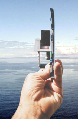
A sextant is an instrument used to measure the angle between any two visible objects. Its primary use is to determine the angle between a celestial object and the horizon which is known as the altitude. Making this measurement is known as sighting the object, shooting the object, or taking a sight and it is an essential part of celestial navigation. The angle, and the time when it was measured, can be used to calculate a position line on a nautical or aeronautical chart.

Using trigonometry to calculate position

To be able to use trigonometry to work out an aeroplane's location over Earth would involve more than just knowing that there is a 90° angle involved. A second angle would need to be calculated to use this method.
Also, no measurements for the sides of the triangle are known - the distance from the viewer to the aeroplane, the distance from the aeroplane to the ground and the distance from that place on the ground to the viewer. Again, more information is needed.

Trigonometry


If one angle of a triangle is 90 degrees and one of the other angles is known, the third is thereby fixed, because the three angles of any triangle add up to 180 degrees. The two acute angles therefore add up to 90 degrees: they are complementary angles. The shape of a right triangle is completely determined, up to similarity, by the angles. This means that once one of the other angles is known, the ratios of the various sides are always the same regardless of the overall size of the triangle.

How to Survive a Plane Crash

20.1.11

Altimeter

A radar altimeter, radio altimeter, low range radio altimeter (LRRA) or simply RA measures altitude above the terrain presently beneath an aircraft or spacecraft. This type of altimeter provides the distance between the plane and the ground directly below it, as opposed to a barometric altimeter which provides the distance above a pre-determined datum, usually sea level.

Radar altimeters are frequently used by commercial aircraft for approach and landing, especially in low-visibility conditions and also automatic landings, allowing the autopilot to know when to begin the flare maneuver.
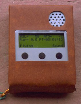

DIY Altimeter


http://www.qsl.net/xq2fod/Electron/Vario/vario.html

Takeoff from London Heathrow, United Kingdom - Airplane Shadow

19.1.11

Flight level

Flight paths

Sizing

Hughes H-4 Spruce Goose
Airbus A380-800
Boeing 747-8 Continental
An-225 Mriya


Various Boeing aircraft

Idea diagram


AIM

This blog is an attempt to put forward thoughts, images, calculations and workings to try to work out an aeroplane's location over Earth when it is seen from the ground.